Think of this trek as a variation of the Salmon Creek hike.
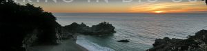
There are sweeping coastal views, waterfalls, and modest oak forests along Soda Springs Creek, but these are junior versions of what you’ll find at Salmon Creek.
While there are no towering redwoods, the canyon along the creek has its own charm and unique features worth a modest hike, perhaps as a followup to one of the others.
Hike Facts:
• Length: 1 mile
• Type: Out & Back
• Difficulty: Moderate
• Path: Varies, tricky
• Elev. Gain: 500 feet
• Parking Fee: No
• Restrooms: No
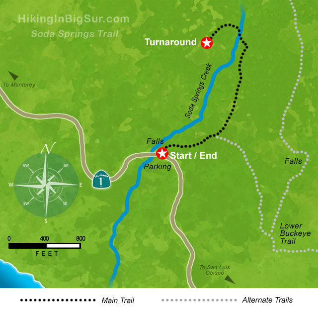
Soda Springs Trail Map
The Hike
After parking in the small pullout, look for the trailhead to the right of the guardrail on the inland side of Highway 1. You’ll be on the south side of the creek.
Immediately to the left as you enter the trees is a short trail down to some falls just yards from the road. This is worth a quick look especially after a nice rain.

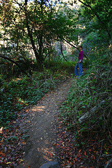

Back up on the main trail, you’ll want to head uphill to the right. In a small clearing a couple dozen yards up is the next branch where you’ll take a left straight up the path.
If you go right here, you’ll head towards the Buckeye Trail which officially joins up less than a half mile down the path. We’re heading left instead to focus on the modest Soda Springs Creek area.
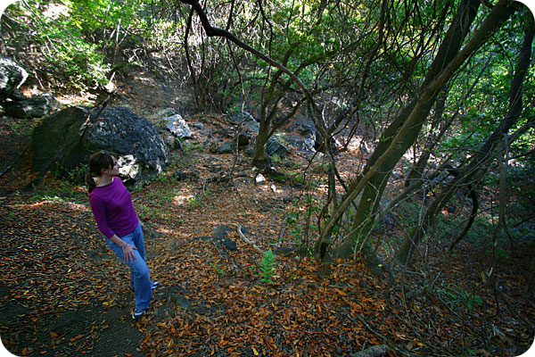
The steep path will take you along the creek canyon wall. Look for some short spurs off to the left which overlook the creek. One in particular leads out to a large rock and viewing area in the sun.
After a scramble past some rocks, the path heads into the trees along a slope and eventually meets up with the creek. There are some charming small waterfalls here, and this would be a great place to eat or rest in the shade.
Walk across the creek on the rocks and look for the path on the other side that heads left up the side of the hill under the trees.
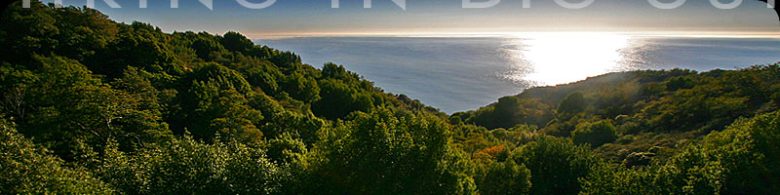
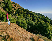
After a short uphill climb, you’ll pop out of the trees at a great west-facing overlook with views along the canyon out to the ocean. This is the turnaround point for our hike.
Alternate Exploring
The Soda Springs trail is typically used as an alternative route to or from the Buckeye Trail, which heads southeast to Salmon Creek or northwest to Buckeye Camp.
Be aware that a few times when we’ve tried this route, we’ve been turned back by overgrown poison oak—and we’re not easily deterred by poison oak.
If the troublesome plant has been trimmed back, consider hiking from Soda Springs down to Salmon Creek or vice versa.
At the junction in the small clearing mentioned in the hike section above, go right instead of left and you’ll run into the Buckeye Trail in less than a half mile.
Go right for Salmon Creek where after another mile or so you’ll eventually drop down to the highway at an abandoned ranger station just north of the start of the Salmon Creek trailhead.
If you turn left onto the Buckeye Trail, you’ll be on your way to Buckeye Camp a couple miles up.
If you don’t want to go all the way, consider taking a short walk about a quarter mile up this path to a seasonal 30 foot waterfall.
Getting There
The Soda Springs Trail starts at a small pullout marked by the sign pictured at right which is easily seen on the inland side of Highway 1.
The pullout is just 1.7 miles north of the Salmon Creek pullout, or 20.3 miles north of the Hearst Castle turnoff.
Travelling south on Highway 1, the pullout is 43 miles south of Pfeiffer Big Sur State Park Entrance or 6.2 miles south of Gorda.