Sand Dollar Beach Trail – All You Need To Know Before Visiting

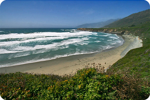
The largest crescent of sandy beach in Big Sur, set below the dramatic Pacific Valley cliffs. Jade too!
The Sand Dollar Beach area offers both a great beach and also a nice bluff trail with expansive views up and down the coast. A perfect place to stop and combine ocean and sand with your trek through Big Sur.
Hike Facts
• Length: .7 mile
• Type: Out & Back
• Difficulty: Easy
• Path: Good, Stairs
• Elev. Gain: 150 feet
• Parking Fee: Yes
• Restrooms: Yes

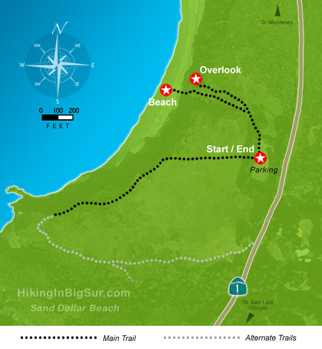
Sand Dollar Beach Trail Map

The Hike
After parking, look to the northwest corner of the lot for the sign and wooden steps that go up and over the fence on the ocean side of Highway 1. You’ll then head straight northwest on the gravel path.
Before going down to the beach, head to the right and take the short trail to the overlook. The overlook has a great view of the entire beach and is also a great place to watch whales and dolphins as they move up and down the coast.

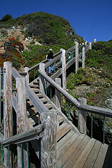
Retrace your steps back to the fork and take the short trail down to the beach as you enjoy one of the best hikes in the Americas. The trail has eroded a bit, but is wide and easy to manage, eventually switchbacking to a large wooden staircase that descends the steepest section.
Sand Dollar Beach is the largest unbroken swathe of sand along the Big Sur coast and due to its protected nature (the high bluffs behind it provide shelter) can be a great place to hang out, even on windy days.
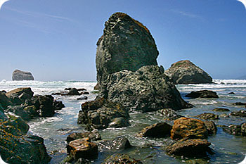
For some, the star attraction will be hunting for jade and other rocks. Guidelines have been created to limit the damage to the area from over zealous rock hounds and are worth reading if you intend to collect some stones. We’ve found the north and south ends of Sand Dollar beach best for poking around for rocks.
Serpentine, which has the same color characteristics as jade, but has no commercial gem stone value, is also abundant in the cliffs and along the beach area. How to tell the difference? Jade is much harder and has a hardness rating of seven (7)—a knife or sharp metal instrument cannot scratch it. The best method for positively identifying jade is to scrape a metal object (like a can opener) across the rock in several places. Serpentine will scratch easily, but if small bits of metal are left on the rock, it is probably jade.
After some time hanging around the beach, head back up the stairs and take a right along the path west of the parking lot. A trail will head south along the bluffs above the beach and offer great views and photo opportunities.

We’ve often been turned back by poison oak up here, so proceed with caution and make sure you can identify the troublesome plant leaves. If the trail is clear, you can wind your way around and back to the highway a short hop south of the parking area.
Alternate Exploring
If you decide to keep going along the bluff, the trail continues south and eventually turns east and winds back up at the highway just south of the parking lot. But as mentioned, and depending on the time of year, the poison oak and lack of trail maintenance makes this is a trail a bit tricky for casual walkers.
Also while you are here, consider heading north a couple miles to pull off at the Pacific Valley Bluffs Trail and/or heading south to the closer Jade Cove trail, which combined with the Pacific Valley Bluffs Trail can make for a great day of bluff and beach.
Getting There
There is a large sign on the west side of Highway 1 marking the entrance to the large parking lot surrounded by trees that is open during daylight hours. There are facilities for picnics as well as restrooms and the trails all start from the west side of the parking area.
You can also park along the west side of Highway 1 just outside the entrance, and the Plaskett Creek campground is across the road on the east side of the highway.
The Sand Dollar Beach parking lot is just 3.8 miles north of Gorda, or 30.3 miles north of the Hearst Castle turnoff.
Travelling south on Highway 1, the pullout is 9.2 miles south of Lucia or 33.3 miles south of the entrance to Pfeiffer Big Sur State Park.


