What Big Sur Hikes to Include in a California Road Trip
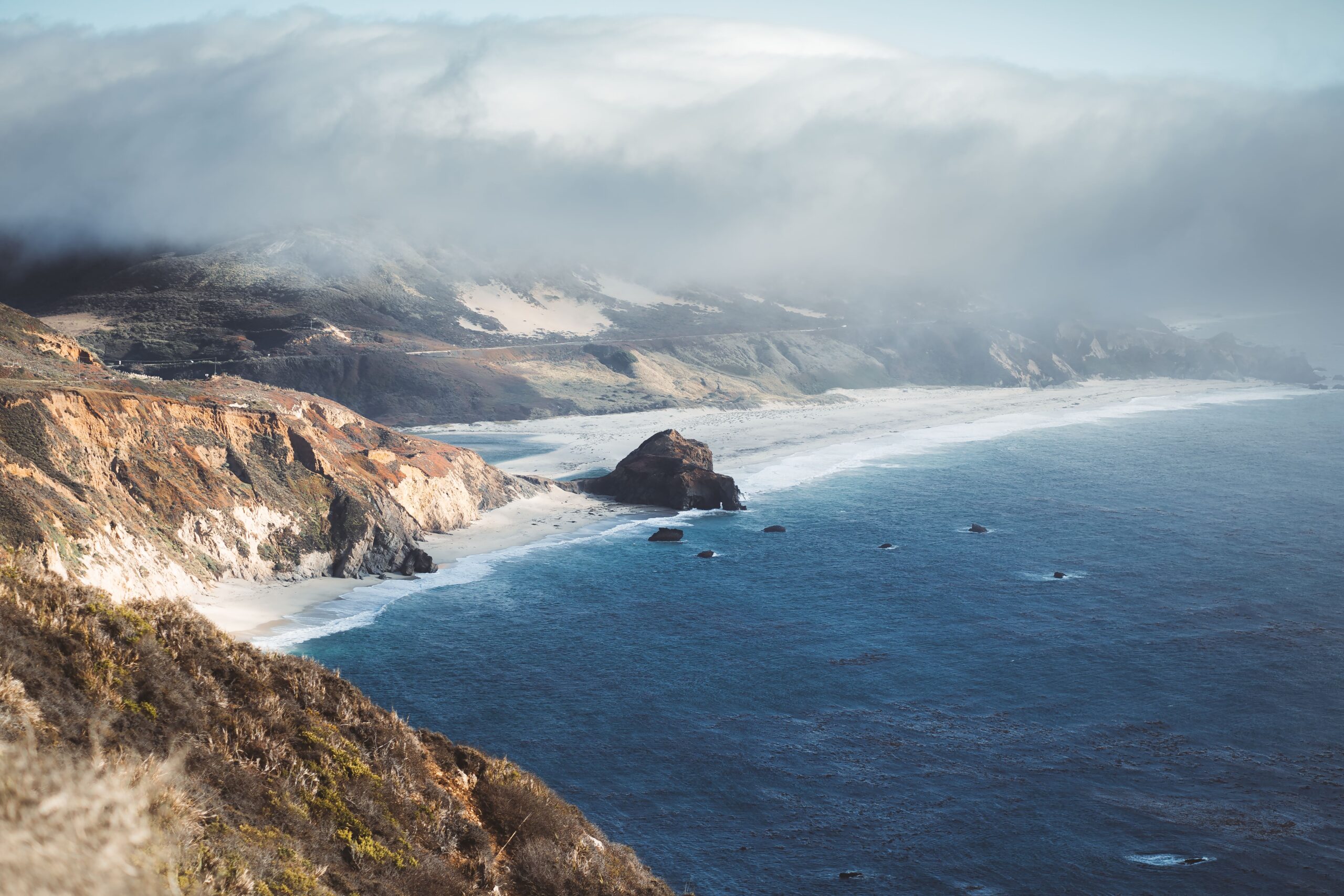
California is a stunning state. It provides everything from top-notch skiing to oceanside surfing and plenty in between. When you look at a map, you may be considering a road trip up and down the Pacific Coast Highway (PCH). A good idea is to follow Highway 1 along the Central Coast and make a stop in Big Sur.
About 90 miles between Carmel and San Simeon are beaches, redwood forests, state parks, waterfalls, and trailheads. Some of the most iconic California spots with little cell service but plenty of regional beauty. The trick is knowing how to include Big Sur hiking on your California road trip. That will take a bit of planning, and this guide can help.
Everything You Need to Know About Big Sur Hiking Road Trips
When you’re building a California road trip, don’t treat the Big Sur area as just another stretch of highway. While you probably don’t want to make a two-week stay here if you have plans up north or way down south over the border, you can hit a few priority hikes for a more rewarding experience.
For example, Garrapata State Park has plenty of short coastal trails for an afternoon without sacrificing the bluff-top Pacific views. There’s also Point Lobos with routes like Cypress Grove and Bird Island. If you go south enough, you can hit Pfeiffer Big Sur, Julia Pfeiffer Burns, and Limekiln. Each one blends massive redwoods with coastal landscapes.
Which Big Sur hikes you do depends largely on how much time you have available outside your car. Doing a 1 to 2 mile hike with only a little elevation change is much less time dependent than a massive 8 mile loop hike where you climb bluffs.
Big Sur Hikes to Add to Your Road Trip
| Big Sur Hike | Location | Approx. Distance | Difficulty | Highlight |
| Cypress Grove Trail | Point Lobos State Natural Reserve | 0.8 mile | Easy | Monterey cypress and coastal views |
| Bird Island Trail | Point Lobos State Natural Reserve | 0.88 mile round trip | Easy | China Cove, cliffs, wildlife, and ocean views |
| Soberanes Canyon Trail | Garrapata State Park | 2.5 miles round trip | Moderate | Canyon vegetation and a wooded inland setting |
| Soberanes Point Trail | Garrapata State Park | 2 miles round trip | Moderate | Coastal headlands and Pacific views |
| Creamery Meadow Trail | Andrew Molera State Park | 2 miles round trip | Easy | Big Sur River crossing and access toward the beach |
| Bluffs Trail | Andrew Molera State Park | 3.4 miles round trip | Easy | Coastal bluff and beach views |
| Buzzard’s Roost Trail | Pfeiffer Big Sur State Park | 3 miles round trip | Moderate to Strenuous | Redwoods, ridge views, and about 750 feet of elevation gain |
| Valley View & Pfeiffer Falls | Pfeiffer Big Sur State Park | About 2 miles round trip | Moderate to Strenuous | Redwood forest, valley overlook, and 60-foot waterfall |
| Partington Cove Trail | Julia Pfeiffer Burns State Park | 1 mile round trip | Moderate | Historic tunnel, rocky cove, and Pacific overlook |
Just check ahead of time with the California State Parks Department. Seasonal wildfires or sudden mudslides can close some trails.
When Remote Work Plans Clash with Highway Miles and Trail Timing
Around 1 in 8 workers in The Golden State work from home. That is in addition to the millions of visitors who flock to California each year for vacation. It’s pretty common for hybrid, remote, and digital nomad workers to visit Big Sur.
The problem you’ll likely run across is connectivity. Big Sur is protected for a reason. There is rough terrain and hard-to-navigate bluffs that make cellphone reception pretty spotty. If you’re planning on things to do in Big Sur like a hike or a beachside picnic, be sure to work around when you need active reception or Wi-Fi access. You may want to:
- Check local Facebook hiking groups for advice on nearby reception areas
- Plan your day around reliable connectivity in a hotel, coffee shop, or California library
- Download any hiking maps before going offline
- Plan important video meetings before and after your hikes
Your vehicle’s fuel is also a concern. Like Wi-Fi, you can run out of fuel in some pretty remote areas. Make sure to fill up before heading into the Big Sur area, and consider purchasing a heat-safe 5-gallon fuel container for your California road trip as a backup.
How Flexible Itineraries Reduce Road Fatigue and Missed Trail Days
Never confuse your California road trip mileage with actual travel time. A scenic 90 miles along a coast might seem like only an hour or two, but it’s extremely different from going 70mph on an interstate.
A family stopping at Bixby Creek Bridge will end up waiting for trailhead parking, likely go for an unplanned coastal walk from all the incredible vistas, spend time taking selfies, have food, and want to sit and soak in the West Coast vibes. That’s going to take up a lot more time.
It’s also worth noting Highway 1 is winding. You don’t get consistent speed. Safe driving on this coastal route takes more time, especially if the weather turns. The point is, don’t try to plan 5 Big Sur hikes in one day. Hit maybe 1 to 2, and give yourself a buffer of plenty of time on either end of the trip.
Understanding Car Shipping Cost for Longer Stays Between States
Some people who finally take the plunge on a California road trip end up turning it into a move, a relocation, or free time after graduating and before starting a new job. Others start in California, then continue the road trip to Oregon, Nevada, or out east. Driving your own car along Big Sur makes sense for flexibility, but maybe not when you have several states ahead of your big move.
An alternative to saving time and hassle after your legs are weak from all the Big Sur hiking is to use professional auto transport. Instead of having to coordinate all details of moving your vehicle, you get reliable support that reduces the stress of fuel, lodging, meals, tolls, and parking. Compare the car shipping cost to your trip’s budget, and you may be surprised at how much easier it can be when you’re on a tight timeline.
A Complete Guide to Keeping Mobility Simple Across Multiple Stops
The most successful Big Sur trips balance your travel freedom with a good dose of preparation. You want enough structure so you’re not wasting the opportunity, but with built-in flexibility so you can switch hikes or hit a local diner along the highway.
Start by mapping your trip. Make sure you have enough fuel, water, and food. Download any offline maps you’ll need for the car ride and the Big Sur hikes you want to take. If you can, group your destinations in the same direction (north to south, etc.) you’re traveling to make it easier.
Two-Day Big Sur Hiking & Road Trip Itinerary
| Day | Stop | What to Do | Approx. Time |
| Day 1 | Point Lobos State Natural Reserve | Hike Cypress Grove Trail and/or Bird Island Trail | 1.5–2 hours |
| Day 1 | Garrapata State Park | Hike Soberanes Point or explore the coastal trails | 1–2 hours |
| Day 1 | Bixby Creek Bridge | Scenic overlook and photos | 20–30 minutes |
| Day 1 | Point Sur Area | Highway 1 scenic stops | 20–30 minutes |
| Day 1 | Pfeiffer Beach | Beach, rock formations, and sunset if timing works | 1–2 hours |
| Day 2 | Pfeiffer Big Sur State Park | Hike Valley View & Pfeiffer Falls or Buzzard’s Roost | 2–3 hours |
| Day 2 | Big Sur Village Area | Lunch and break from driving | 1 hour |
| Day 2 | Julia Pfeiffer Burns State Park | See McWay Falls when the overlook is open | 30–60 minutes |
| Day 2 | Partington Cove | Hike to the cove when the trail is open | 1–1.5 hours |
| Day 2 | Southern Big Sur Coast | Scenic Highway 1 overlooks and sunset | 1–2 hours |
Explore All Big Sur Hiking Spots
Before you leave, make sure you have a first aid kit, sun and other weather protection, and a way to check local hiking conditions before you leave your car. Always double-check wildfire conditions, and you should be all set to explore massive redwoods, picturesque coastline, and all that Big Sur, California has to offer.
Remember to check out a professional auto shipping company as well. It’s a reasonable way to reduce your travel time and stress after you’ve taken in the incredible views along Big Sur.