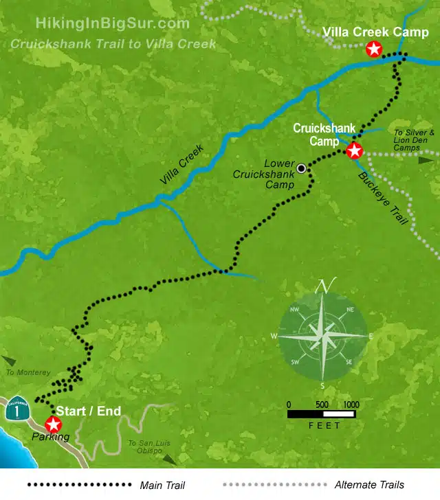
Cruicshank Trail to Villa Creek Camp
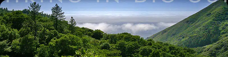
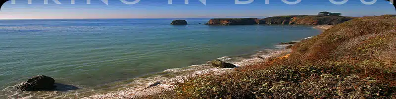
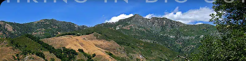
Great mountain, ocean and creek views, along with a wide variety of tree and plant life. This trail has it all.
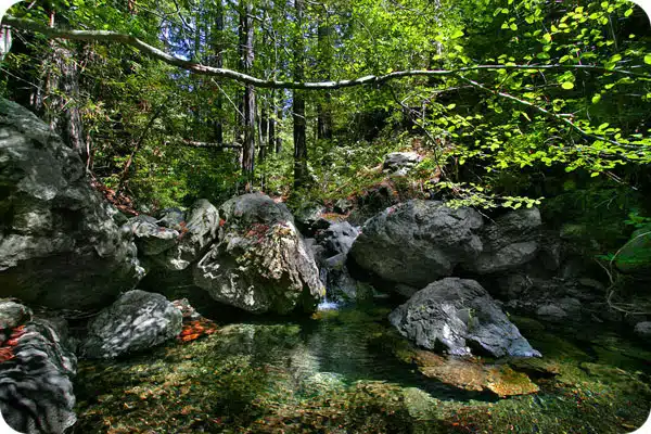
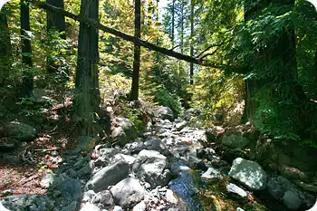
After an initial set of switchbacks, the Cruickshank Trail is a fairly straight run along the canyon above Villa Creek, eventually winding down towards Villa Creek Camp and it’s gorgeous redwood setting near several small waterfalls and sun-dappled pools of water.
Hike Facts:
• Length: 6 miles
• Type: Up & back
• Difficulty: Strenuous
• Path: Steep, overgrown
• Elev. Gain: 1200′
• Parking Fee: No
• Restrooms: No
Cruicshank Trail Map
The Hike
Some Big Sur trails instantly reward you with giant redwoods and rocky streams. This one requires you to work a bit for it.
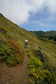
After parking, look for the trailhead next to the sign on the east side of the road. For the first several thousand feet you’ll ascend a series of moderately steep switchbacks which take you up the mountain opposite a small neighborhood of homes.
You’ll soon veer north and then east around the mountain leaving the developed world behind as you enter the Silver Peak Wilderness area.
The trail flattens out, changing from coastal scrub to the Big Sur equivalent of jungle. Be sure you can identify poison oak, since it lines this trail pretty much from here on in. Though you can generally avoid contact with the troublesome plant, sandals and shorts are not recommended. Periodically the trail is completely clear—usually for brief stretches.
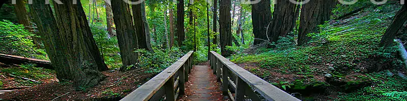
There are beautiful oak forests along the Cruickshank Trail, as well as several small stands of Redwood. One unusual site just short of two miles in, on the north side of the path, is a stand of eucalyptus trees which look (and are) very out of place in this environment.
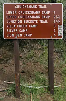
At two miles you’ll encounter the Lower Cruickshank Camp in a small clearing on the north side of the trail, and just a bit further arrive at the Upper Cruickshank Camp area. Both campsites have firepits and seating for a rest or snack.
At the Upper Camp is a trailsign indicating the Villa Creek Camp to the left or the junction for the Buckeye Trail ahead to the right. If you head right, you can also continue on about a mile to Silver Camp or even further to Lion Den Camp.
However, for this day hike, we strongly recommend that you continue to the left three quarters of a mile down the canyon to Villa Creek and its campsite.
The path is steep heading down into the redwoods, and you’ll soon hear the loud rushing of the creek. Drop down to the creek and continue on the other side. Keep going west along the right or northern side of Villa Creek until you get to the campsite with picnic table and tent area. This is a our turnaround spot, although the trail does continue on for several miles and eventually reaches the Alder Creek Botanical Area.
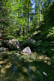
Just past the Villa Creek campsite, a short path heads a few yards west to the creek itself where you’ll find a series of tranquil pools and small waterfalls surrounded by large bolders. This is a great spot to have lunch or linger for several hours as you contemplate the hike back up the canyon.
Alternate Exploring
If you want more trail time after visiting Villa Creek Camp, or something different for your next time around, consider heading east from Cruickshank Camp towards Silver Camp or even all the way to Lion Den camp. Another option would be to explore the upper part of the Buckeye Trail.
At the Upper Cruickshank Camp a sign points the way, ahead and to the right for a short distance, to a junction where you can continue to either the Silver and Lion Den Camps along the Cruickshank Trail or take a right to continue in a southeastern direction as far as you like down the Buckeye Trail.
Getting There
The Cruickshank Trail starts from a small grassy pullout right along Highway 1. It’s easy to miss, so look for the sign (pictured at right under the map) that is a few feet off the inland side of the road.
You can park along the east side of Highway 1 next to, or just south of, the sign, or park north of the sign on the pullout on the west side of the highway. There is a private road just south of the trailhead called Gorda Mountain Road.
The Cruickshank Trail starts .9 mile north of the Redwood Gulch Memorial Redwood Grove, or 22.9 miles north of the Hearst Castle turnoff.
Travelling south on Highway 1, the Cruickshank Trail sign is 3.6 miles south of Gorda or 40.7 miles south of the entrance to Pfeiffer Big Sur State Park.
Links To More Information
• Where this trail lies along the Big Sur coast
• Aerial photos of the trailhead